A broad frontier province of temperate plains stretching across a hundred to several hundred miles, the region is a patchwork of rivers, marshes, and rolling hills that support farms, herds, and busy river trade. Magic is common and practical, used for irrigation, weather mitigation, and livestock care, while market towns, waystations, and scattered homesteads form a developing network of trade and fragile alliances.
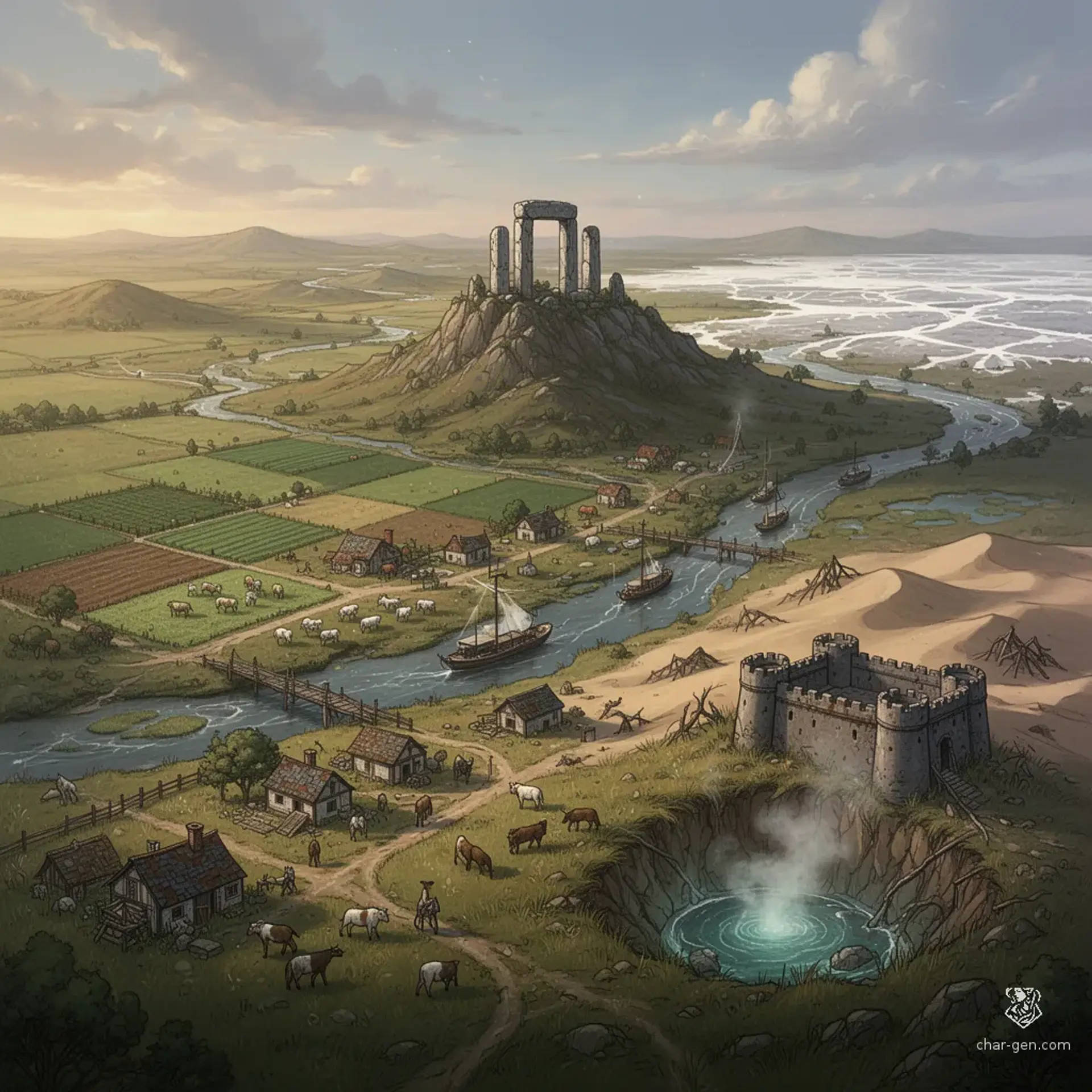
The Great Northern Plains
Region AtlasFrontierProvince (150-300 miles)
The Great Northern Plains
Wide grass, winding rivers, and the slow hum of frontier life.
PopulationSparse to moderate across the plains with denser…
ClimateTemperate with warm summers, cold winters, and…
TerrainWide sweeping plains with rolling low hills and…
StabilityFractured but functional with frequent local…
Visual sheet
Turn The Great Northern Plains into a sheet
A high-res, share-ready sheet you can post or print.
Gallery
The Great Northern Plains Image
Settlements
Windford
Market townLarge
Major river market and ferry hub.
Red Hollow
Ranching villageMedium
Center of seasonal herding and wool trade.
Northwatch
Fortified waystationSmall
Defensive outpost and toll collection point.
Marshgate
Marsh villageSmall
Marshland trade and herb harvesting center.
Stoneford
River portMedium
Local iron processing and toolmaking hub.