A temperate riverland of fertile meadows, slow channels, and reed-choked marshes spanning roughly a hundred miles of connected waterways. Settler communities cluster along dikes and ferries, aided by high magic that controls floods and enchants tools. The rivers enable trade, seasonal migration, and political ties, while the marsh keeps outsiders wary and fosters unique crafts and rituals tied to water and soil.
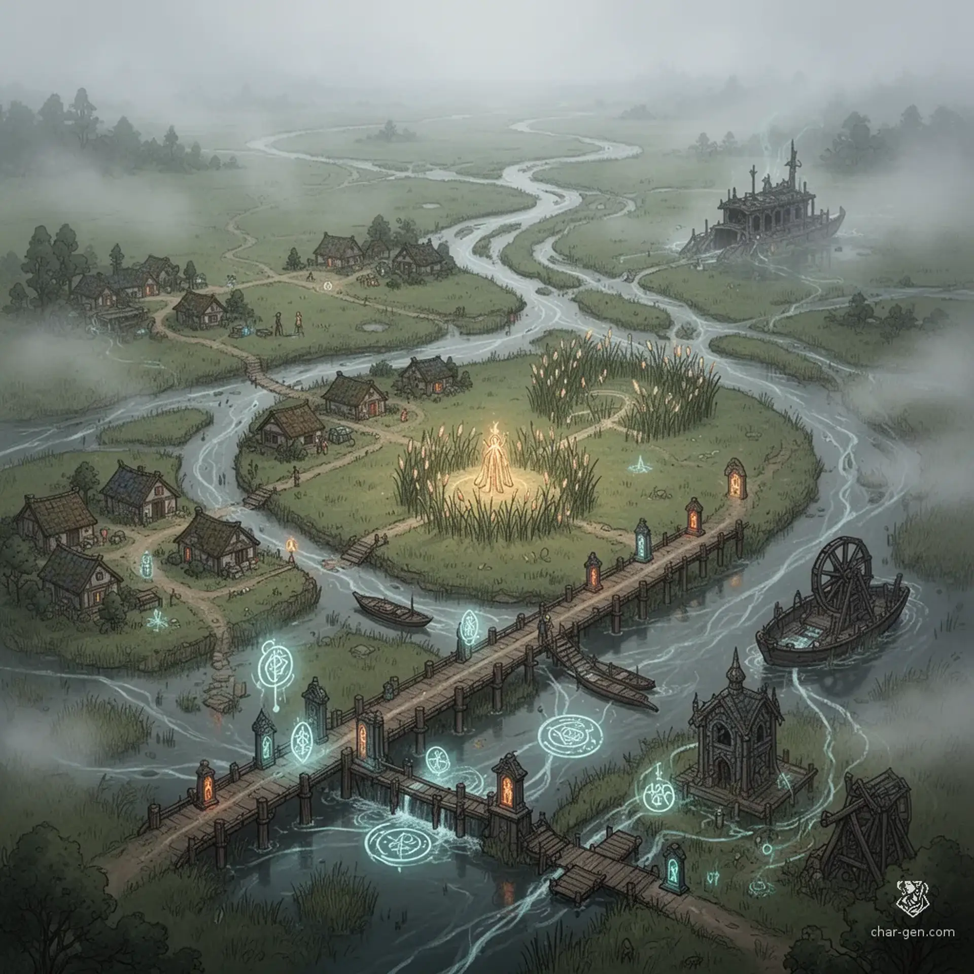
The Low Lands
Region AtlasLowlandsRegional (50-150 miles)
The Low Lands
Where the river gives life and claims the unwary.
PopulationModerate density concentrated along waterways and…
ClimateTemperate with mild winters, warm summers, and…
TerrainFlat riverlands cut by braided streams and…
StabilityFragile stability reliant on cooperation between…
Visual sheet
Turn The Low Lands into a sheet
A high-res, share-ready sheet you can post or print.
Gallery
The Low Lands Image
Settlements
Riverford
Market townMedium
Regional trade and boatbuilding center.
Marshgate
Marsh hamletSmall
Specialist center for reed goods and fish curing.
Broadford
Dike townMedium
Control point for local water management.
Fenham
Service townSmall
Hub for magical services and charms.
Reedham
Linear villageSmall
Producer of reedcraft and seasonal labor pool.