Skip to content
CreatePricing
The Rel - AI-generated fantasy Region

The Rel

Region AtlasEmpire ProvinceNation, approximately 300 to 600 miles across

The Rel

Where every harvest is a blessing, every road remembers a war, and the gods still collect their due.

PopulationModerate across the plains, dense around…
ClimateMediterranean, with hot dry summers, mild wet…
TerrainBroad rolling plains broken by limestone ridges,…
StabilityStable in the shrine belt, tense along the…
The Rel is a nation-sized imperial province of sunlit plains, old shrines, and contested miracles. Its grain roads connect hundreds of villages, fortified market towns, pilgrim stations, and temple estates across several hundred miles. Divine favor is treated as a practical force that can bless crops, expose criminals, or destroy armies. Beneath the region’s orderly roads and fertile fields, ancient clearances and buried relics threaten to reopen old wars.
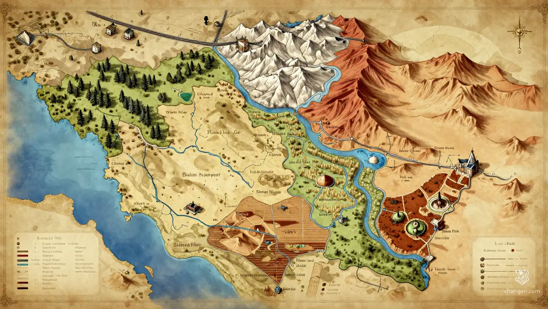
Field Observations

Roads are reliable near shrines but become flooded during spring rains.,Caravans often travel between watchtowers because open fields offer little shelter.,Pilgrim routes receive divine hospitality, though strangers may be questioned at every shrine.

Cultures

The Sun-Covenant tradition, which measures social duty through ritual offerings and signs of divine favor.

The Field-Oath communities, whose seasonal festivals bind farming, marriage, and military service.

The Two-Table tradition, formed from rival temple schools forced into a shared calendar.

The Reed-and-Clay influence, carried by migrant traders, scribes, and canal workers.

Industries
Grain cultivation
Vineyard farming
Pilgrim services
Canal transport
Trade Goods
Wheat
Olive oil
Purple dye
Consecrated relics
Imports
Fine steel
Incense resins
Warhorses
Trade Hubs
Cleared Gate
Table-and-Altar Market
Joined Quays

Geography

ClimateMediterranean, with hot dry summers, mild wet winters, and violent spring storms.
TerrainBroad rolling plains broken by limestone ridges, shallow valleys, irrigation canals, and scattered temple mounds.
Biomes
Sun-baked grain plains
Olive and cypress groves
Seasonal reed marshes
Dry limestone uplands
Waterways
The Divided River
The Long Canal
The Reedwater
The Joined Streams
Borders
The imperial heartlands beyond the northern military road
The salt coast beyond the western flats
The hill confederacies beyond the eastern escarpment
The southern desert caravanlands

Demographics

Temple-aligned agrarian families
Imperial settlers and administrators
Canal wardens and caravan clans
Minor Groups
Hill shepherds
Pilgrim artisans
Marsh fisher communities
Languages
Relic Cant
High Imperial
Market Greek
Reed-Speech

Economy

Status

Comfortable in temple corridors and trade towns, but uneven in frontier villages.

Visual sheet

Turn The Rel into a sheet

A high-res, share-ready sheet you can post or print.

Gallery

No images yet. Click to add.

Settlements

Cleared Gate

Fortified market townLarge

Northern customs station and military supply center

Table-and-Altar

Shrine townLarge

Religious center and pilgrimage destination

Joined Quays

Canal townMedium

River commerce and barge construction

White Basin

Pilgrim hostel settlementSmall

Pilgrim refuge and relic exchange

Ridge-and-Plain

Fortified market villageMedium

Border market and livestock center