Skip to content
CreatePricing
Kesh - AI-generated fantasy Region

Kesh

Region AtlasRainforest and volcanic upland regionLarge regional territory spanning rainforest lowlands, volcanic uplands, river basins, and connected trade roads.

Kesh

Where every road remembers, the jungle keeps the truest warning.

PopulationDense along waterways and ancient roads, sparse…
ClimateHot and humid in the lowlands, cooler and…
TerrainDense rainforest rises toward broken volcanic…
StabilityGenerally stable along the roads, but strained by…
Kesh is a broad rainforest and volcanic upland region where ancient jungle roads connect river towns, crater villages, quarry camps, and bridge cities. Rain, ash, and living architecture shape daily life as thoroughly as law or religion. Practical magic is common, from healing sap and heat-fed kilns to spoken Edicts that persuade roots, stone, and memory. Travelers find wealth beside danger, with every road carrying old promises and imperfect recollections.
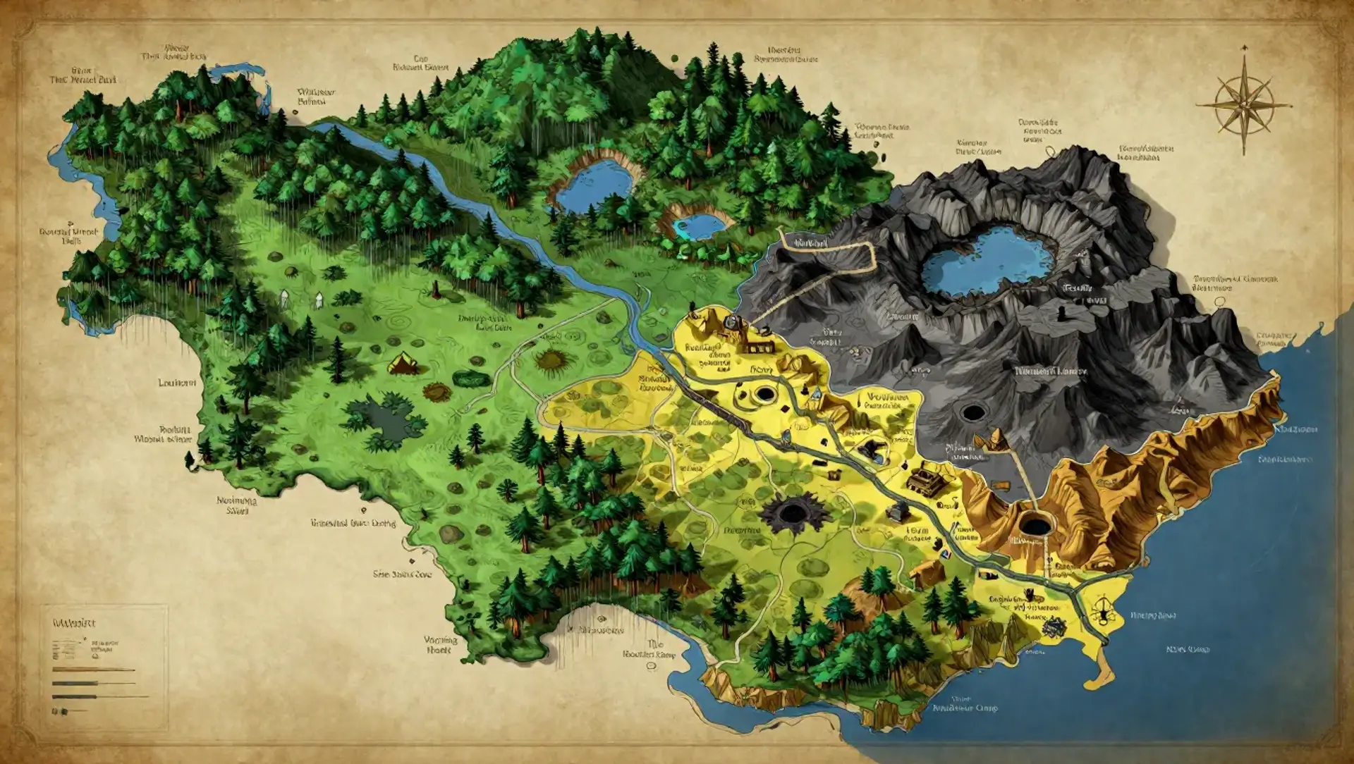
Field Observations

Rain can erase trails within hours, but living roads often reopen toward remembered destinations.,Volcanic passes may shift after tremors, ashfall, or careless Edict magic.,River travel is fast downstream and dangerous where drowned ruins constrict the channels.

Cultures

Keshan canopy communities preserve memory through living wood, communal feasts, and practical household magic.

Upland clans honor volcanic ancestors, bloodline talents, and strict guest-right around crater settlements.

Roadward traders blend Avarran customs with foreign languages, portable shrines, and contract-bound Edicts.

Industries
Living architecture and bridgecraft
Medicinal cultivation and alchemy
Volcanic quarrying and pottery
River trade and caravan services
Trade Goods
Memory-carved timber
Rare medicines and resins
Obsidian tools and glazed ceramics
Spice, dyes, and luminous fungi
Imports
Worked iron and steel tools
Salt and preserved grain
Fine cloth and glass vessels
Trade Hubs
Remembered Crossing
Warning Market
Last Safe Landing

Geography

ClimateHot and humid in the lowlands, cooler and stormier in the uplands, with heavy seasonal rain.
TerrainDense rainforest rises toward broken volcanic ridges, crater basins, hanging valleys, and ancient elevated roads.
Biomes
Lowland rainforest
Cloud forest slopes
Basalt uplands
Crater lakes and ash meadows
Floodplain marshes
Waterways
The River That Turned Back
The Whitewater Below
The Deep Green Run
The Waterfall Without a Source
Borders
The western salt roads of Avarra
The northern high passes beyond the cloud forest
The eastern riverlands below the volcanic rim
The southern coastward jungle

Demographics

Canopy villagers and bridgewright families
Volcanic upland clans
Roadward merchants and caravan households
Minor Groups
River hermits and medicinal adepts
Foreign artisans and pilgrim communities
Languages
Keshan Trade Speech
Upland Keshic
Avarran Common
Old Edict Cant

Economy

Status

Moderate and uneven, with road towns prosperous while isolated upland villages rely on barter.

Visual sheet

Turn Kesh into a sheet

A high-res, share-ready sheet you can post or print.

Gallery

No images yet. Click to add.

Settlements

Remembered Crossing

Living bridge cityLarge

Regional road junction and artisan center

Warning Market

Rainforest trade townLarge

Caravan exchange and contract court

Last Safe Landing

Floodplain settlementMedium

River port and resupply station

The Ash Steps

Terraced crater villageMedium

Upland quarry and pottery center

The Roadless Camp

Temporary-to-permanent campSmall

Frontier mining and salvage site