Skip to content
CreatePricing
Crow Pass - AI-generated fantasy Region

Crow Pass

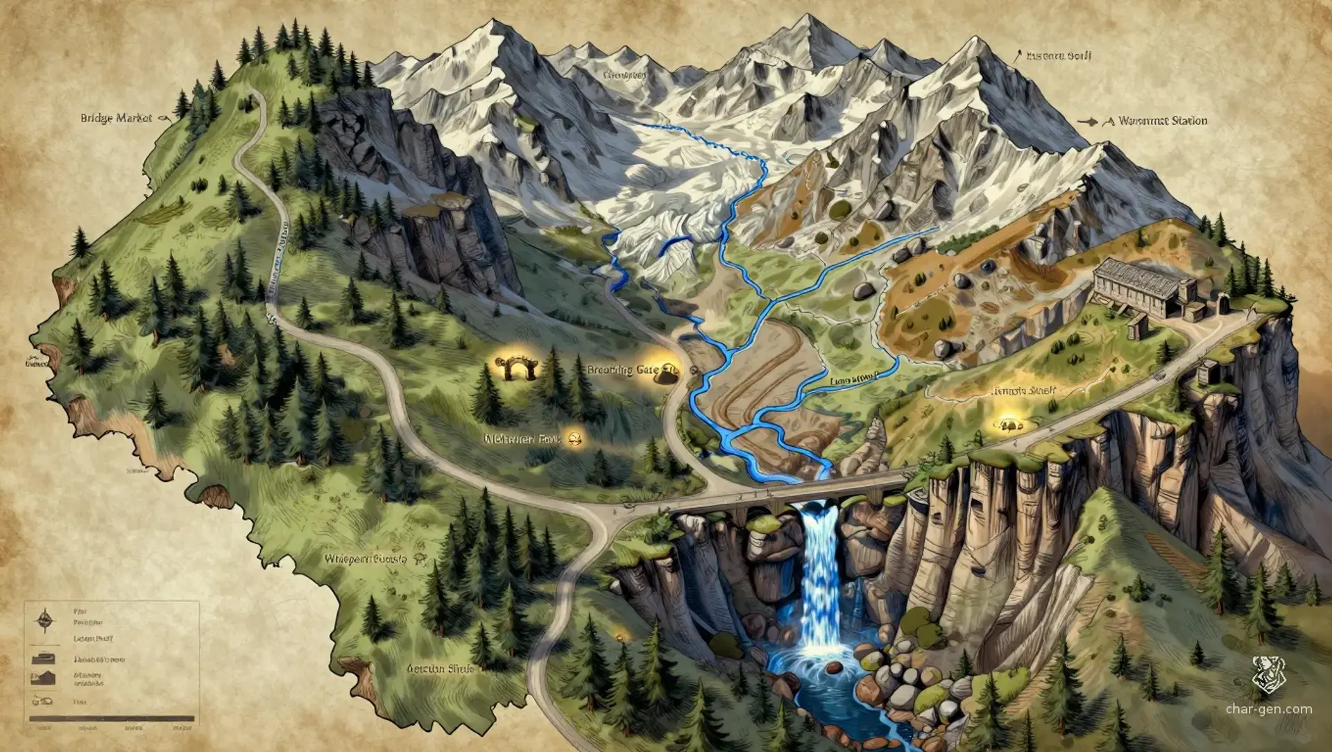
Region AtlasMountain pass regionA large regional corridor spanning mountain roads, forested slopes, cliff settlements, mining valleys, and border approaches.

Crow Pass

Where warm breath rises from stone, every echo may be a warning.

PopulationSparse overall, with dense settlement clusters…
ClimateCold mountain weather dominates, but warm air…
TerrainA narrow high route winds between pine slopes,…
StabilityFunctional but strained, with trade profits,…
Crow Pass is a broad, dangerous mountain region forming a vital bridge between Turicum’s greenlands and the Ashland. Pine-covered slopes rise toward sheer cliffs, fractured ridges, and routes cut into ancient stone. Settlements cling to ledges, ravines, and sheltered basins wherever water and trade permit. Magic is common and practical, but the newly opened pass has changed its character, exhaling warm air and carrying voices from somewhere beyond the mountains.
Field Observations

Avalanches can close exposed routes without warning.,Sure-footed guides are essential on cliff roads and rope bridges.,Voices carried by warm air may reveal danger or lure travelers off the trail.

Cultures

Greenland caravan traditions emphasize mutual aid, trail songs, and practical charms.

Ashland border communities prize endurance, secrecy, and fire-tested craftsmanship.

Passfolk blend both traditions through seasonal trade, intermarriage, and shared mountain rites.

Industries
Pass toll collection
Mining and stonecutting
Mountain forestry
Caravan services and guiding
Trade Goods
Iron ore and black crystal
Pine resin, timber, and medicinal herbs
Ashglass ornaments and heatproof ceramics
Imports
Grain and fresh fruit from the greenlands
Coal, glass, and alchemical reagents from the Ashland
Fine cloth and manufactured tools
Trade Hubs
Bridge Market
Warmvent Station
The Splitroad Yard

Geography

ClimateCold mountain weather dominates, but warm air from the reopened pass creates sudden thaws, fog banks, and localized growing pockets.
TerrainA narrow high route winds between pine slopes, sheer cliffs, hanging valleys, broken bridges, and mineral-streaked ravines.
Biomes
Subalpine pine forest
Wind-scoured alpine meadow
Glacier-cut cliff country
Warm fissure scrubland
Waterways
Crowrun River
Meltwater Fork
Warmvent Brook
Blackglass Falls
Borders
The greenlands lie beyond the northern descent.
The Ashland begins beyond the southern ravines.
The western ridge separates Crow Pass from unmapped high valleys.
The eastern escarpment drops toward old mining country.

Demographics

Pine-slope clans
Ashland-descended settlers
Mixed caravan families
Minor Groups
Cliff hermits
Giant-blooded miners
Languages
Common Trade Speech
Greenlandic
Ashland Cant

Economy

Status

Uneven and practical, with prosperous trade centers beside poor isolated hamlets.

Visual sheet

Turn Crow Pass into a sheet

A high-res, share-ready sheet you can post or print.

Gallery

No images yet. Click to add.

Settlements

Bridge Market

Waystation townLarge

Primary caravan exchange and meeting place

Warmvent Station

Fortified stationMedium

Fissure monitoring and southern passage control

Pine Hollow

Logging hamletSmall

Forest resource center

Lantern Shelf

Cliffside settlementMedium

Craft production and rescue coordination

Ashstep Camp

Caravan campSmall

Refugee shelter and caravan staging ground