Skip to content
Create
The Red Corridor - AI-generated fantasy Region

The Red Corridor

Region AtlasOtherRegional, approximately 50 to 150 miles across, requiring two to five days of hard travel between major routes.

The Red Corridor

Between two suns, every trail leads north and every shadow may be waiting.

PopulationVery sparse, with most inhabitants clustered…
ClimateA moving sun governs ordinary day and night,…
TerrainRed dunes surround black rock outcrops, dried…
StabilityFragile and practical, maintained by shared fear…
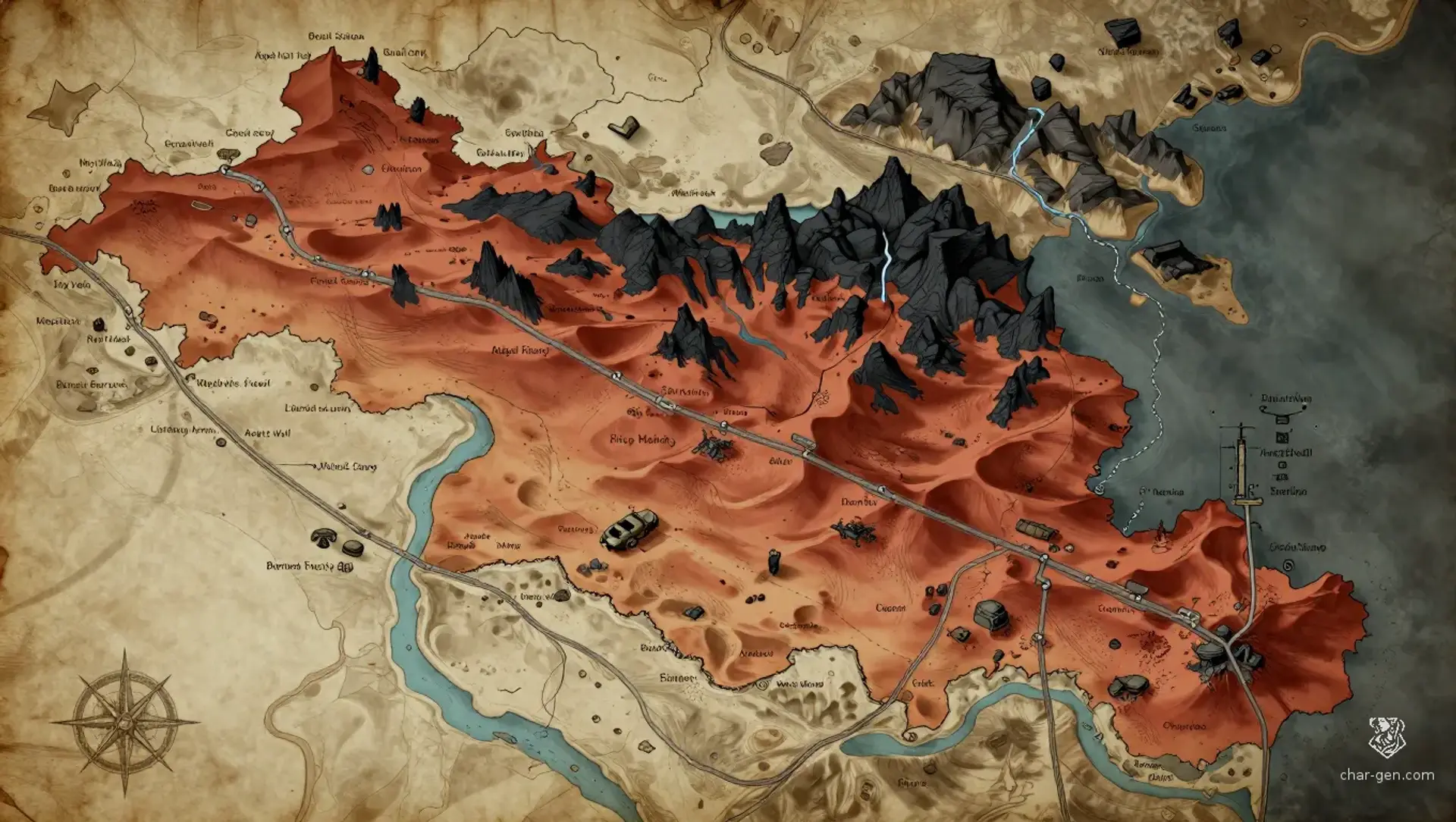
The Red Corridor is a regional wasteland stretching between The Black Station and The Factory. Its red sand, dead ravines, and black stone formations conceal military ruins from a failed age. Travelers cross it under two suns, one predictable and one erratic, while sandstorms erase evidence of passage. Sparse wells support scattered camps, caravan stops, and Chitinikk trading sites. The region feels empty until signs of pursuit appear, then every ruin seems positioned to observe the road.
Field Observations

Sandstorms can erase tracks and force travelers into exposed shelter.,Night travel reduces heat exposure but brings dangerous cold and hidden predators.,The pursuit usually takes two to five days, with the Order holding a head start.

Cultures

Wasteland survival customs shaped by scarcity, salvage, and strict water etiquette.

Chitinikk exchange traditions centered on fungus, barter, and practical neutrality.

Order conditioning persists in abandoned camps, patrol habits, and coded road marks.

Industries
Salvage diving in pre-apocalyptic ruins
Fungus cultivation and trade
Caravan escorting and route guiding
Scavenged fuel recovery
Trade Goods
Filtered water
Industrial scrap
Medicinal fungus
Recovered weapons
Imports
Clean water
Metal tools
Preserved food
Trade Hubs
The Black Station approaches
Angels Well
The Factory road

Geography

ClimateA moving sun governs ordinary day and night, while a fixed sun irregularly dims or brightens, causing sudden heat waves and cold snaps.
TerrainRed dunes surround black rock outcrops, dried ravines, rusted vehicle wrecks, buried facilities, and scattered military ruins.
Biomes
Red sand desert
Broken rock fields
Dried ravine networks
Ruined military corridors
Waterways
The Dry Vein is a winding ravine that carries floodwater only during rare storms.
The Red Wash marks an old drainage channel between several ruin sites.
The Buried Conduit is a sealed pre-apocalyptic water system beneath the northern flats.
Borders
The Black Station lies to the south.
The Factory road and northern wastes lie to the north.
Open salt flats mark the eastern edge.
Jagged badlands form the western edge.

Demographics

Scavenge hunters and independent salvagers
Chitinikk fungus traders
Nomadic caravan families
Minor Groups
Loose Order personnel
Ruin-dwelling hermits
Languages
Trade Cant
Common
Chitinikk clicking speech
Order sign-language

Economy

Status

Poor overall, though salvagers and caravan brokers can become temporarily prosperous.

Visual sheet

Turn The Red Corridor into a sheet

A high-res, share-ready sheet you can post or print.

Gallery

No images yet. Click to add.

Settlements

Waystation

Caravan yardSmall

Neutral resupply point

Red Hollow

Ruin outpostSmall

Salvage and black-market center

Angels Well

Well townMedium

Regional trade hub

Burrow Market

Chitinikk trade warrenSmall

Fungus trade and information exchange

Watch Camp

Fortified shelterSmall

Route surveillance and escort hiring