Skip to content
CreatePricing
The Aro Hills - AI-generated fantasy Region

The Aro Hills

Region AtlasReligious and cartographic upland strongholdA large multi-valley region crossed in several weeks, with numerous villages, market towns, estates, shrines, and fortified roads.

The Aro Hills

Every road is measured, every boundary remembers, and one name waits to disappear.

PopulationModerate along valleys, springs, roads, and…
ClimateHot, dry summers, cold clear nights, brief…
TerrainThe Aro Hills spread across broad dry uplands cut…
StabilityGenerally stable, though rural councils resist…
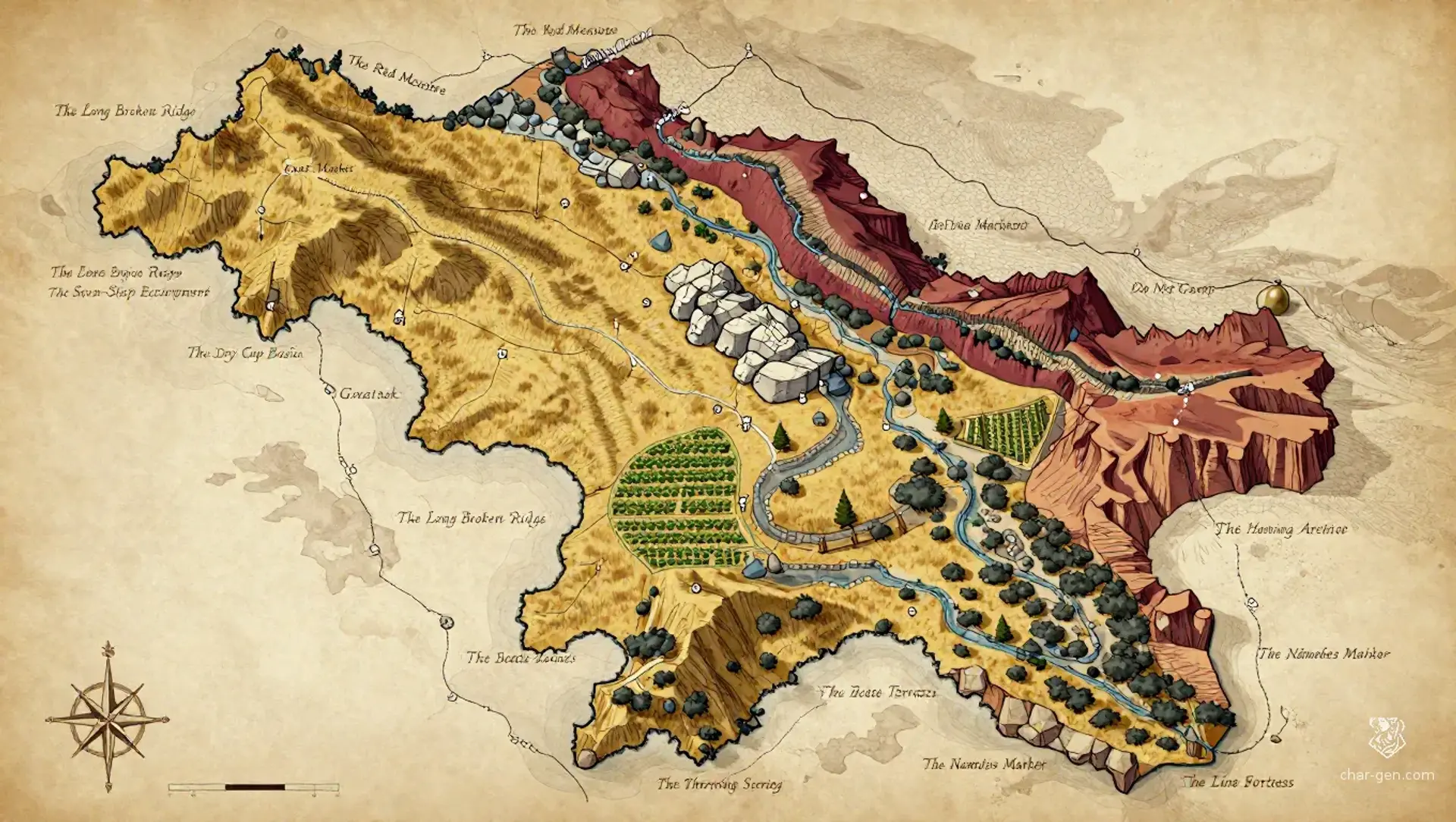
The Aro Hills are a broad belt of dry uplands, vineyard terraces, and broken limestone ridges in Kharu. Pilgrim roads cross the region beside survey stones, shrine walls, and fortified archives where every boundary carries religious weight. The hills are prosperous but tense, because mythic sorcery has altered them before and could do so again. Beneath a church fortress lies a marker rumored to erase one name from every map, memory, and official record.
Field Observations

Reliable roads follow marked stones, but unmarked shortcuts may cross dangerous debt-lines.,Water skins matter more than armor during summer crossings.,After rain, dry gullies become sudden torrents and erase lesser trails.

Cultures

The Aro hillfolk preserve boundary songs, vineyard rites, and inherited warnings against redrawing old lines.

The Surveyor communities value exact speech, public records, and contracts witnessed by soil, blood, and measured cord.

The Dryland caravanners blend upland customs with distant market traditions, carrying portable shrines and practical omens.

Industries
Vine cultivation
Mapmaking and surveying
Pilgrimage services
Stone quarrying
Trade Goods
Aged red wine
Survey cords
Terraced grain
Carved boundary stones
Imports
Worked iron
Salt cakes
Fine paper
Trade Hubs
Gnat Market
Mind the Drop
Do Not Camp

Geography

ClimateHot, dry summers, cold clear nights, brief violent rains, and long winds that scour exposed ridges.
TerrainThe Aro Hills spread across broad dry uplands cut by ravines, vineyard terraces, limestone shelves, and steep broken ridges.
Biomes
Dry upland grasslands
Terraced vineyards
Broken limestone hills
Juniper scrub valleys
Waterways
The Red Measure
Gnatwash
The Bitter Run
The Threading Spring
Borders
The salt flats beyond the southern escarpment
The high survey road toward Kharu's central basin
The cracked eastern tablelands
The pilgrim passes descending into western low country

Demographics

Vineyard hillfolk
Chartered mapmakers
Dryland caravanners
Minor Groups
Fortress clergy
Quarry families
Seasonal pilgrim bands
Languages
Aro Cant
Surveyor's Measure
Kesh Trade Speech

Economy

Status

Comfortable in the mapped valleys, uneven in the uplands, and visibly prosperous around religious roads.

Visual sheet

Turn The Aro Hills into a sheet

A high-res, share-ready sheet you can post or print.

Gallery

No images yet. Click to add.

Settlements

Gnat Market

Market townLarge

Regional market and caravan exchange

Mind the Drop

Fortified road townMedium

Pass control and pilgrim shelter

The Line Fortress

Church fortressLarge

Religious and administrative center

Do Not Camp

Waystation villageSmall

Water stop and boundary watch

Beetle Terraces

Vineyard villageMedium

Wine production and rural council seat