Skip to content
CreatePricing
The Kanadhin Lands - AI-generated fantasy Region

The Kanadhin Lands

Region AtlasFrontier250 miles across

The Kanadhin Lands

A fertile cradle of blood and blossom locked within iron peaks.

PopulationModerate in the valley basin and sparse…
ClimateArid and variable with freezing winters and…
TerrainHigh altitude mountain ranges encircling a…
StabilityHighly volatile due to constant warfare over…
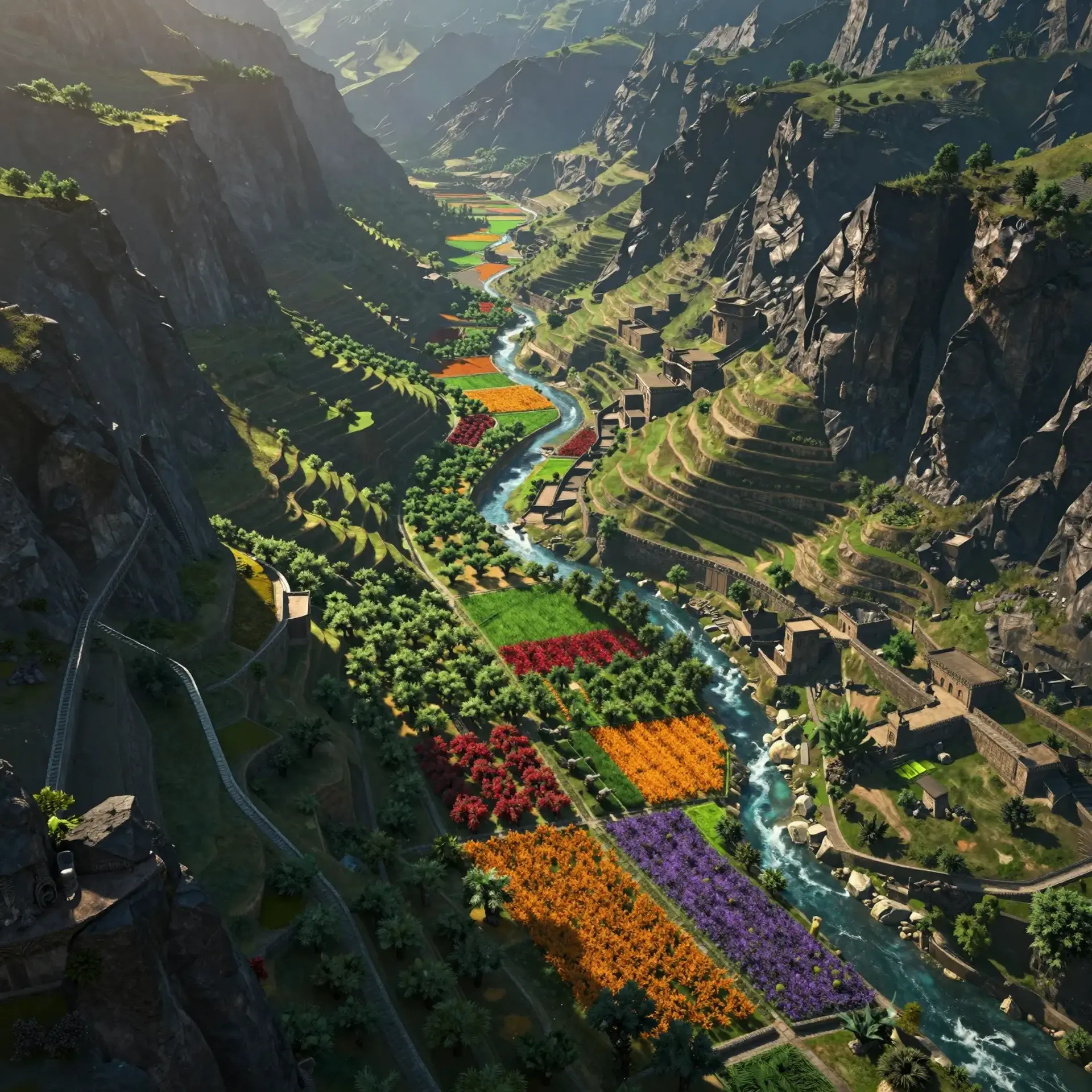
The Kanadhin Lands encompass the rugged mountain ranges surrounding the Kandar, a lush and highly prized agricultural basin. While the peaks are mineral-rich and harsh, the valley below yields a bounty of rare fruits and potent spices. Warlords constantly vie for control over this green jewel, driven by the strict edicts of the Quom warrior religion. In this low-magic frontier, faith and steel govern life while nomads follow ancient seasonal paths through the high mountain passes.
Field Observations

Mountain passes are frequently blocked by heavy winter snows.,Caravans require armed escorts due to frequent warlord skirmishes.,Travelers must carry extra water when crossing the dry shrubland.

Cultures

Traditional mountain nomadism following the seasons.

Hard-line religious asceticism focused on The Quom.

Settled agrarian life centered on the Kandar valley.

Industries
Intensive terrace agriculture and orchard management.
Mining of precious stones and copper ore.
Livestock herding for wool, meat, and dairy.
Trade Goods
Dried apricots and fresh pomegranates.
Saffron, Bango, and processed Papaver.
Raw copper and polished lapis lazuli.
Imports
High quality iron for weapons and tools.
Textiles and silks from the western plains.
Maritime salt transported via caravan.
Trade Hubs
The Southern Gate acts as the primary export point.
The Northern Ore Market handles all mineral transactions.
The Central Orchard Exchange is the heart of spice trade.

Geography

ClimateArid and variable with freezing winters and scorching summers.
TerrainHigh altitude mountain ranges encircling a central fertile valley.
Biomes
Alpine tundra atop the highest peaks.
Semi-arid shrubland on the lower slopes.
Fertile alluvial plains within the Kandar valley.
Rocky scree slopes along the canyon edges.
Waterways
The Kandar River flows through the central valley.
Seasonal snow-melt streams cascade down the peaks.
Ancient underground irrigation channels support the orchards.
Borders
The Scorched Steppes lie to the south.
The Iron Tooth Peaks mark the northern edge.
The Great Silk Gate provides entry from the west.

Demographics

Sedentary Kandar farmers who tend the orchards.
Highland miners specializing in stone and metal extraction.
Nomadic herders who follow seasonal migration patterns.
Minor Groups
Foreign spice merchants waiting for harvests.
Displaced refugees fleeing from active war zones.
Languages
Kandari is the common tongue of the valley.
High Quomic is used for all religious and legal texts.
Various mountain dialects are spoken by the nomadic tribes.

Economy

Status

Extreme disparity between the wealthy warlords and the common laborers.

Visual sheet

Turn The Kanadhin Lands into a sheet

A high-res, share-ready sheet you can post or print.

Gallery

No images yet. Click to add.

Settlements

Highcrest

Fortified TownMedium

Military Watch

Greenleaf

Farming HubLarge

Agricultural Center

Deepmine

Mining OutpostSmall

Resource Extraction

Windpath

Nomad CrossingVariable

Trade Site

Riverstay

Valley MarketMedium

Commerce