Skip to content
CreatePricing
Skaig Whal - AI-generated fantasy Region

Skaig Whal

Region AtlasCity-State frontierContinental (600+ miles)

Skaig Whal

A continent of soaring peaks and shifting sands where magic fuels the fires of industry.

PopulationSparse in the interior deserts but very high in…
ClimateThe climate varies from sub-arctic in the high…
TerrainHigh altitude mountains give way to vast sand…
StabilityFragile, as competition for resource-rich land…
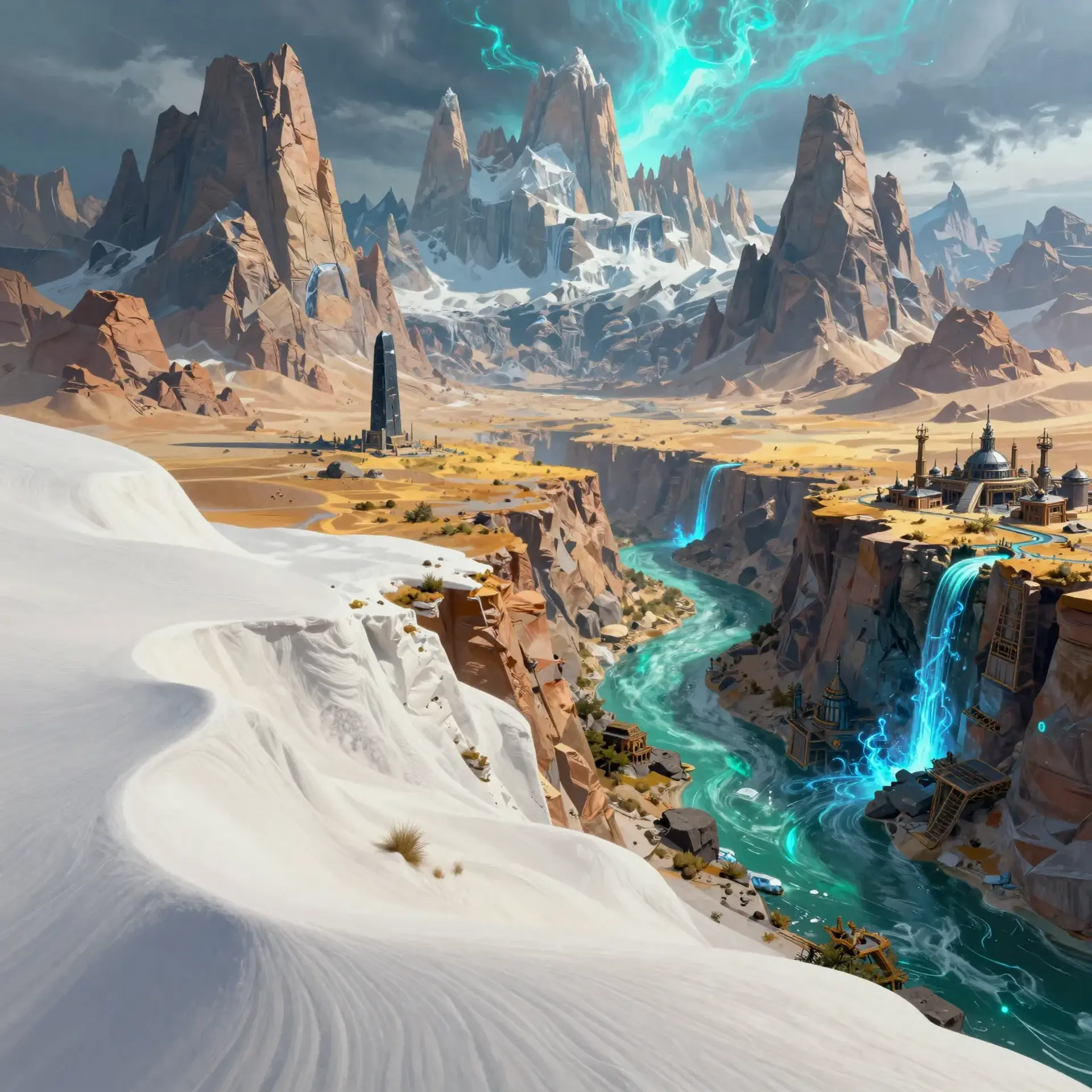
Skaig Whal is a massive landmass defined by extreme verticality and abundant arcane energy. From the ice-capped Duneyrr Mountains to the blistering White Prairie, the geography challenges all who attempt to settle its borders. Magic is a common tool for survival, integrated into everything from river navigation to desert travel. Despite the harsh environments, the continent's rich mineral deposits and sprawling river systems support a network of fiercely independent city-states and rugged mining outposts.
Field Observations

Altitude sickness is a persistent threat when crossing the central mountain chains.,The Regin River offers the only reliable passage through the central continent.,Desert guides are essential for surviving the mirages of the White Prairie.

Cultures

Stoic mountain-industrialists focused on stone and steel.

Nomadic desert-mystics who interpret the patterns of the sand.

Cosmopolitan river-merchants who value fast wit and faster ships.

Industries
Deep-crust mining
Arcane research and development
Continental river transport
Trade Goods
Refined mithral
Enchanted navigation crystals
Dried desert spices
Hardy highland livestock
Imports
Grain and cereal crops
Fine silks and textiles
Naval machinery
Trade Hubs
The Iron Port
Oasis Cross
Reginmouth

Geography

ClimateThe climate varies from sub-arctic in the high peaks to arid desert heat in the central plains.
TerrainHigh altitude mountains give way to vast sand prairies and deep river canyons.
Biomes
Sub-arctic alpine ranges
Arid white sand deserts
Temperate river floodplains
Rolling highland scrublands
Waterways
The Regin River spans the north and south length of the continent.
The Blainn River cuts through the heart of the Duneyrr Mountains.
The Agros River flows from the Gidal heights into the eastern plains.
Borders
The Brokk Sea defines the rugged western coastline.
The Emorette Sea borders the verdant eastern reaches.
Unmapped tundra lies beyond the northern Duneyrr range.

Demographics

Highland Dwarves
River-faring Elves
Human frontiersmen
Minor Groups
Kobold mining collectives
Nomadic Half-Giant clans
Languages
Common Trade
Ancient Dwarvish
Low Elvish
Mountain Dialect

Economy

Status

Extremely high for a frontier region due to rare mineral exports.

Visual sheet

Turn Skaig Whal into a sheet

A high-res, share-ready sheet you can post or print.

Gallery

No images yet. Click to add.

Settlements

Highmount Dock

Trading TownLarge

River Trade

Sandshelf

OutpostSmall

Desert Waystation

Grey Peak

Mining CityMedium

Mineral Extraction

Riverbend

Agricultural VillageSmall

Food Production

Port Brokk

SeaportMedium

Maritime Export