The Mirewarren Basin - AI-generated fantasy Region

The Mirewarren Basin

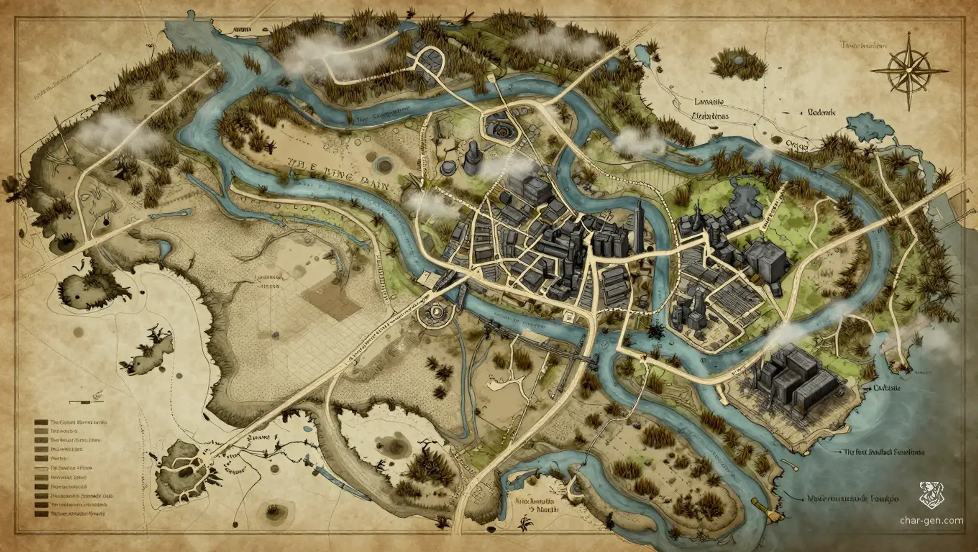
Region AtlasUrban marshland basinA large regional basin containing many connected cities, ports, villages, industrial districts, and underground complexes.

The Mirewarren Basin

Where every crowded street rests upon a forgotten road below.

PopulationVery dense around ports, warrens, foundries, and…
ClimateHumid and temperate, with long wet seasons, heavy…
TerrainA broad lowland basin of canals, muddy rivers,…
StabilityFunctional but strained by labor unrest,…
The Mirewarren Basin is a broad lowland homeland of the Mireclaws, where marsh villages grew into sprawling cities of canals, warrens, foundries, and buried civic works. Crowded ports feed industrial districts, while old tunnels weave beneath modern streets. The region feels industrious, damp, and watchful, with every neighborhood layered over older roads, forgotten machine halls, and contested spaces claimed by guilds, families, smugglers, and things that never left the dark.
Field Observations

Flooding can erase roads and isolate districts within hours.,Licensed guides are essential in abandoned tunnels.,River traffic is faster than most roads but vulnerable to tolls and sabotage.

Cultures

Mireclaw urban traditions

Canal-barge mercantile customs

Foundry district labor culture

Old-city civic traditions

Industries
Metalworking
Canal shipping
Reclamation and salvage
Textile production
Trade Goods
Machined tools
Boiler parts
Dyed cloth
Preserved river foods
Imports
Grain
Fine timber
Medicinal herbs
Trade Hubs
Lowwater Exchange
The Iron Quays
Murkmarket

Geography

ClimateHumid and temperate, with long wet seasons, heavy fogs, and hot industrial summers.
TerrainA broad lowland basin of canals, muddy rivers, crowded cities, raised roads, and buried infrastructure.
Biomes
Floodplain marshes
Dense urban warrens
Industrial riverbanks
Subterranean civic tunnels
Waterways
The Graywater River
The Long Drain
The Rust Canal
The Brackish Run
Borders
The northern reed frontier
The eastern upland road
The southern saltwater coast
The western blackwood margin

Demographics

Mireclaws
Mixed urban beast-folk communities
Human and halfling merchants
Minor Groups
Tunnel-dwelling scavengers
Displaced rural families
Languages
Mireclaw Cant
Trade Common
Canal Sign
Understreet Code

Economy

Status

Unevenly prosperous, with wealthy trade houses beside crowded working warrens.

Visual sheet

Turn The Mirewarren Basin into a sheet

A high-res, share-ready sheet you can post or print.

Gallery

No images yet. Click to add.

Settlements

Lowwater Exchange

Canal portLarge

Primary commercial crossroads

The Civic Warrens

Urban warrenVery large

Administrative and cultural center

Iron Quays

Foundry portLarge

Industrial shipping hub

Reedbank

Floodplain villageMedium

Marshland food supplier

Old Gate

Road townMedium

Border checkpoint and salvage base